We tend to make "loop drives" because we start at home and rarely come back the same way. This particular drive required a 20-mile drive west on a state highway to Balloon Tree Road. That Forest Service road then heads east across some of the Blue Mountains back home. (Some day, we'll remember to note the mileage on one of these trips.)
At the beginning of the drive, this is the wide, smooth road. Going down into the valley was a different experience.
Generally, this is the season for Sticky Asters, but this flower doesn't match the wildflower book.
This is a variety of globe mallow, most likely the Checker Mallow.
This tall pink flower is most likely the Mountain Globemallow.
These are Blue Pod Lupines; generally they are late spring bloomers, but this year wildflowers were blooming much longer at higher elevations.
This is the "edge" that is above our goal of the valley floor where home is.
Indian Valley, where Elgin (pop. 1700) is the only town. "The Knob" formation is in the foreground.
The downhill road was rocky and rough, with a lot of curves.
It's difficult to see just how rough this road is, but much of it was washed out from the heavy spring rains and melting snow.
This land once was owned by the local timber company but was sold to an investment company, whose only purpose is to cut trees to make money. Most likely, this is a logging road; the area was logged a few years ago so most of the trees are young.
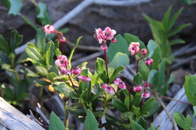
This odd little flower is probably a "Little Pipsissewa" -- a Native American name for a plant used to treat kidney stones.
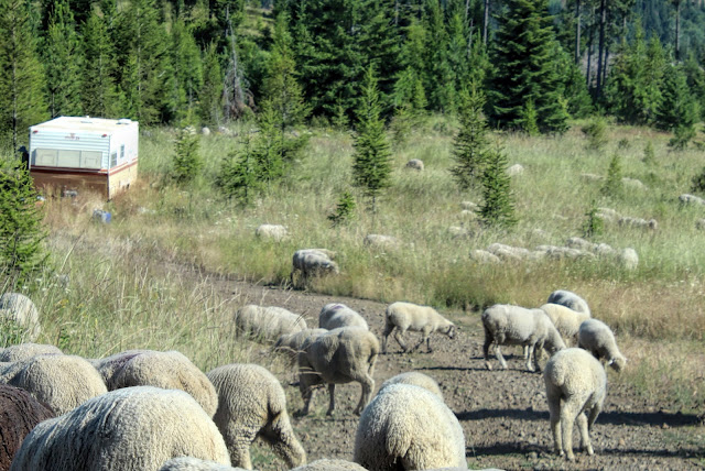
Just like that, as we were rockin' and rollin' on the rocky road down to the valley floor....we came on a herd of sheep.
This is a terrible photo, but during our descent we drove by the sheep herder and his tiny trailer home for the summer. Generally, the herders are Central Americans.
Right after this photo was taken, one of the big herd dogs came bounding out of the brush, barking ferociously. These dogs bond with the sheep, not with the humans. They defend their 4-legged charges against real and imagined dangers.
I was happy we had driven this loop, but I said I'm not really interested in repeating the drive. 😉


1 comment:
I always loved to take rides like this.
Post a Comment