Crater Lake was formed when a massive eruption of Mount Mazama 7700 years ago caused the mountain to collapse, leaving a steaming caldera. Centuries of rain and snow filled the caldera creating Crater Lake.
Photos can speak for themselves.
 |
| Deepest lake in the United States |
 |
| Lake is filled by only rain and snow; there are no inlets or outlets |
 |
| Reminder of the 44 feet of annual snow on the lake rim |
 |
| The shape of the caldera is obvious here |
 |
| Plaikni Falls ... a hike of over a mile |
 |
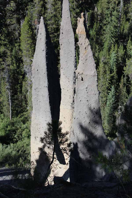
| Pinnacles |
 |
| Pinnacles..."chimneys" of ash from the eruption nearly 8,000 years ago |
 |
| Two 35-passenger tour boats on the lake |
 |
| Skeleton of white bark pine on a rock crag above the lake |
 |
| Pumice Castle |
 |
| Phantom Ship |
 |
| Vidae Falls--along the rim highway |
 |
| Wizard Island...a small volcano within the caldera |
 |
| The water is blue from any elevation, including the two-hour boat tour. |
 |
| The "strenuous" path from top to bottom and bottom to top can be seen in this photo. 1.1 miles to gain 700 feet in elevation---a little more than 30 minutes of hiking. |
 |
| Path near water level |


7 comments:
Wow. A stunning place. You must've had a ball with your camera on this trip. Bravo!
Nice shots! Thank you for the tour.
What a beautiful place! All the pictures are great and I especially like the one framed by the tree trunks, the pine tree skeleton and the "sparkly" water with the Phantom Ship! :)
i was going to ask how you get down to the water .. and then you showed us .. awesome place .. exquisite photos
Gorgeous pictures where is this place?
What a wonderful series. Your photos showcase the beauty of Crater Lake.
The rock formations here are fantastic -- great captures of your trip. xo
Post a Comment